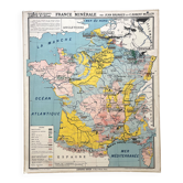
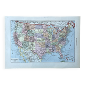
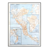
🌍 Old school map Vidal-Lablache 51, 1940 - United States, Mexico

- Dimensions :
- H100 x W120
- Color :
- multicolour
- Material :
- paper
- Style :
- industrial
🌐 Old school map of geography representing the United States of America and Mexico. 🌐 Scale 1 / 2, 000, 000. Original Vidal-Lablache collection. 1940s. Armand Colin Bookstore, Paris. Dufrénoy Printing, Paris. Print 11, list of maps up to 64. Polychrome cardboard poster. Dimensions: 120 × 100 cm. Front: 51 Physical and agricultural map (Rocky Mountains, Appalachians, Pacific, Atlantic, Cuba...) Back: 51 bis Political map (New York, Chicago, Mexico, Canada, Detroit, Philadelphia...) Medallions: Legend, list of maps, Northeastern states (New York) Very good condition: paper border and metal eyelets present, minor signs of use, beautiful preserved colours. Nice patina and historical interest. Ideal for vintage decoration, collection, or original gift! FREE SHIPPING FOR THIS MAP (in France, via Relais Colis or Colissimo). For abroad, costs will be calculated based on the destination (international Colissimo). Map carefully shipped in a thick cardboard prism in France or abroad (worldwide). All types of payment accepted: bank transfer, PayPal, cheque, or via the site. Hand delivery possible around Roanne and Lyon (cash or PayPal payment). Discount for multiple posters and maps purchased from my listings. Over 300 vintage posters and maps to discover on VintAffich: Auzoux, Belin, Boucau, Bourrelier, Bruley, Brunhes, CDN, Colin, Delagrave, Deyrolle, Galtier-Boissière, Gibert, Hachette, Hatier, Kaeppelin, La Pie, Maltruchot, Mézières, MDI, Nathan, Ogé, Peyre, Rossignol, Scolathèque, Teissier, Trotignon, Varon, Vidal-Lablache. 51VL9.
Earth globes & geographical maps: other similar vintage pieces
Discover more similar items- -11%
- -22%