Page 1 of 6
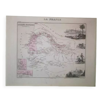
Old illustrated map of the Antilles Guadeloupe Grande-Terre – 1840
€56
Old illustrated map of the Antilles Guadeloupe Grande-Terre – 1840
€56
- Dimensions :
- H36 x W53
- Color :
- black
- Material :
- paper
- Style :
- vintage
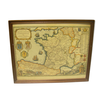
Old map of the French colonies in America (Guadeloupe, Grande Terre, Marie-Galante, Les Saintes, Saint Martin, La Désirade) taken from an old atlas. 💎 ALL lithographs and maps in this account are ORIGINALS and not copies Other maps, notably illustrated on the French departments, are also available on this account. Date: publication of the work in the 1840s Dimensions: approximately 53 X 36.5 cm To be framed Vintage engraving for gift idea and decoration for country houses, gîtes, restaurants and guest houses, hotels, Point à Pitre.