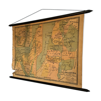
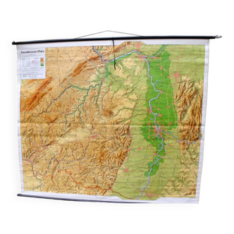
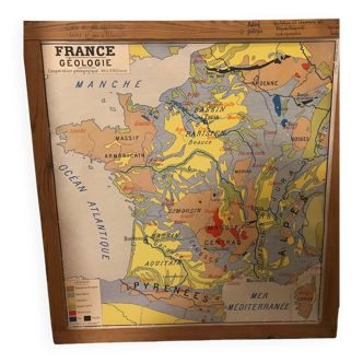
Map of France 1906 entoilated Editions Scarbourough
🙈 Oops, this product is already sold or unavailable. Discover our 1500 new products or products similar to this item !
- Dimensions :
- H100 x W100
- Color :
- multicolour
- Material :
- canvas
- Style :
- classic
Map of france pre-first world war, alsace is in germany. On this large, covered map, lined with the metal tubes around which it wraps, are the distances between all the cities, the populations for each commune according to the 1906 census, and a lot of wonderful information such as distance in railway set saves between all the cities served. 18 regions, departments with their ancient names, soft colors like douce france. Very good condition, with a small wear of the canvas at the top left. The original hanger yaw is still there. Very beautiful object, useful and poetic. The map itself 1m x 1m. Add 2 cm on each side for the metal tubes.
4.89 ()