


Page 1 of 5
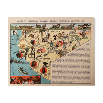
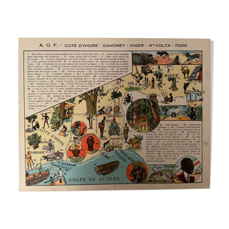
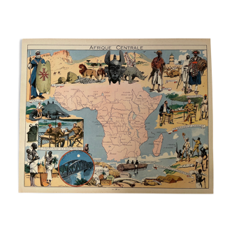
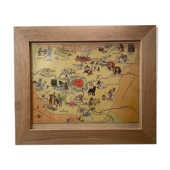
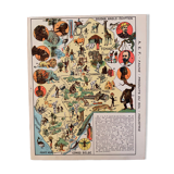
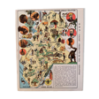
Old poster map of French Equatorial Africa (soil products and industry) - 1931
€38
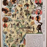
Old poster map of French Equatorial Africa (soil products and industry) - 1931
€38
- Dimensions :
- H30 x W24
- Color :
- multicolour
- Material :
- paper
- Style :
- vintage
Old map of the a. E.f french equatorial africa (soil products and industry) illustrated by a. Fauchere and a. Galland, taken from "la france d'outre-mer illustrée", published by blondel la rougery. Date: 1931 (rare) Dimensions: 24 X 30 cm. To be framed. Lithograph, engraving, painting, decoration, decoration, vintage, gift idea. Geography cartography france sudan cameroon chad gabon.