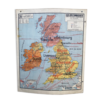
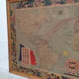
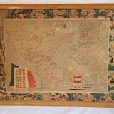
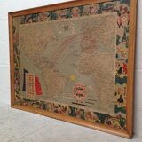
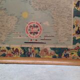


Map of the lines of the General Transatlantic Company 1959 framed
🙈 Oops, this product is already sold or unavailable. Discover our 1500 new products or products similar to this item !
- Dimensions :
- H82 x W105 x D3
- Color :
- multicolour
- Material :
- wood
- Style :
- vintage
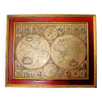
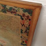
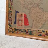
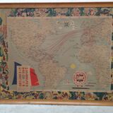
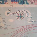
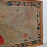
Old large map of the lines of the Compagnie Générale Transatlantique, published in Paris in 1959 by the publishing house Blondel La Rougery. The map is decorated with a compass rose, five liners, and a French flag on which is placed a table of the countries served with their flags. The map indicates, in red, the maritime lines, the main airlines, and the transatlantic hotels. The borders are decorated with scenes and characters illustrating the countries served. The map has its wooden frame. The whole is in good original condition, the colors have faded a little over time but this gives it a beautiful vintage feel. Dimensions: 105 cm X 82 cm.