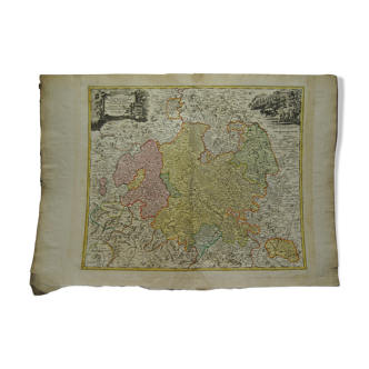
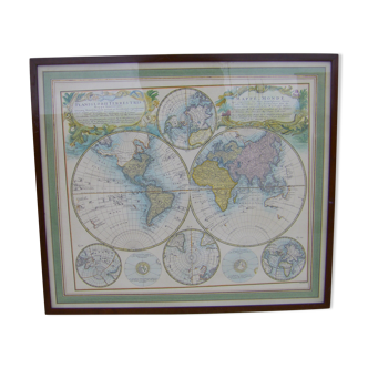
Martigues pond Old geographical map 18th century engraving 1764 by Bellin
This item has found its owner, but other one-of-a-kind items await you. 👇
Discover similar items- Dimensions :
- H35 x W26 x D2
- Color :
- white
- Material :
- paper
- Style :
- classic
We offer you this martigues pond old geographical map 18th century engraving 1764 by bellin this old map, entitled "martigue pond and surroundings", offers a detailed view of the martigues region in france. This is a valuable historical document that provides insight into the geographic features and environment of martigues in the 18th century. The map is part of the "petit maritime atlas", a work by the famous cartographer jacques-nicolas bellin, published in 1764. It constitutes a window into the past, offering an overview of the coastal landscape and geographical knowledge of the region from martigues to that time. Bellin was a major manufacturer of nautical charts for the marine depot. He was born in paris in 1703 and trained as an engineer. He produced many important maps and published them individually or in compilations. The french neptune was published in 1753 and the french hydrography in 1756. His most important and complete work is the petit atlas maritime. Beautifully framed and under glass (two small accidents in the gilding) dimensions frame 35 / 26 cm card 33 / 24 cm superb low price. To enter.