Sold out


Page 1 of 15
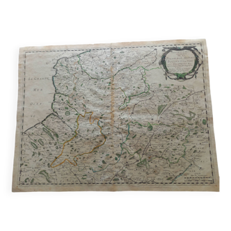
Large atlas map 1834 palestine & arabia petree by andriveau-goujon, history of the hebrews, plan
This item has found its owner, but other one-of-a-kind items await you. 👇
Discover similar items- Dimensions :
- H64 x W50 x D1
- Color :
- black
- Material :
- paper
- Style :
- classic
Large map of "palestine and arabia petree for the understanding of the history of the hebrews from their exit from egypt, until the advent of the messiah", plan engraved on large sheet format 50 X 64cm, folded central corresponding to the fold in the atlas, small tears at the edge and water marks at the level of the legend otherwise otherwise proof map. Published in 1834 by andriveau-goujon, rue du bac in paris, extracted from his universal atlas no. 2. Small additional plans of jerusalem before jesus christ and the israelite camp in the desert. Rolled packaged weight 250g.