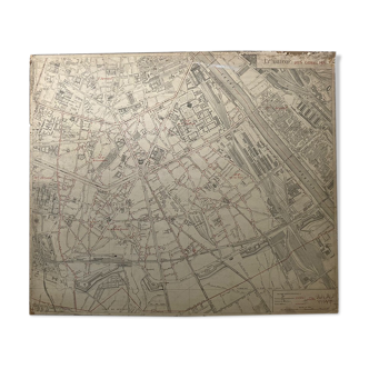
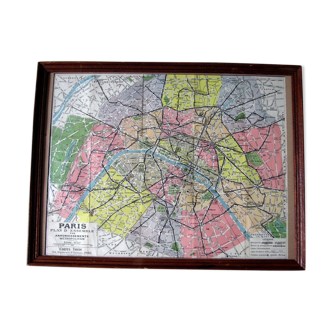
Map of London at the end of the 19th century
This item has found its owner, but other one-of-a-kind items await you. 👇
Discover similar items- Dimensions :
- H46 x W31 x D1
- Color :
- multicolour
- Material :
- paper
- Style :
- vintage
Original old map dating from 1883. 31x46cm. This is indeed an old original document and not a reproduction. 📦 sent flat folded on itself between several layers of cardboard in order to make the package unfoldable, this type of old document cannot be rolled. Original central fold is hardly visible once unfolded see photos. Do not hesitate to contact me to make a batch to save on shipping costs: for maps and lithographs you only pay one shipment. old map of london - artheme fayard edition Detailed map of **london**, published by **artheme fayard**, finely illustrating the urban organization of the British capital. It highlights the main districts, monuments, parks and infrastructures, testifying to the growth of the city at the time. Composed of **red, blue, green and black** shades, this map offers a precise and harmonious reading of the London landscape. The **Thames**, a central element structuring the city, is particularly highlighted, while a detailed legend lists the emblematic places, facilitating the interpretation of the different urban areas. In a good state of preservation, this document is a fine example of old cartography, appreciated as much for its historical interest as for its aesthetics. It will fit perfectly in an office, a library or a collection dedicated to urban history and cartography.