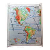
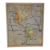
Old school map of the American continent by Vidal Lablache
This item has found its owner, but other one-of-a-kind items await you. 👇
Discover similar items- Dimensions :
- H120 x W100 x D1
- Color :
- multicolour
- Material :
- paper
- Style :
- vintage
Vintage Physical Map of the American Continent – Vidal-Lablache (1950s) Superb Vidal-Lablache school wall map depicting the American continent (North America, Central America, and South America). Double-sided map with mounting eyelets: One side features a key (with legends) One side is a blank map (without legends) This map dates from the 1950s and has a beautiful period patina. Signs of wear are visible in the photos, adding to its vintage charm. 📏 Dimensions: Height: 120 cm Width: 100 cm Fast and secure shipping within France and internationally. School map, wall map, antique map, Vidal-Lablache, American continent, geographical map, vintage map, physical map, wall decoration, America
Earth globes & geographical maps: other similar vintage pieces
Discover more similar items