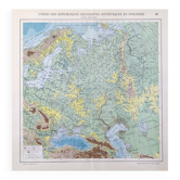
Old school map Hatier 27, 1940 - Indian Ocean, Antarctica

- Dimensions :
- H120 x W100
- Color :
- multicolour
- Material :
- paper
- Style :
- vintage
🌐 Old school wall map representing the Indian Ocean, the seas of the East Indies, and the Antarctic continent. 🌐 Original Brunhes collection. By Camille Vallaux, 1940s/50s. Hatier Bookstore, 8 rue Assas Paris. Demersseman Printing, Gaillac-Monrocq, Paris. Polychrome cardboard poster. Dimensions: 120 × 100 cm. Front: 27 Indian Ocean and Antarctica (Australia, Asia, Africa, main currents...) Back: 27 bis blank map. Medallions: Monsoon currents, area, depth of oceans and seas, distance from ports, legend. Excellent condition: two brass eyelets for hanging, fabric border present, small signs of use and age possible, very beautiful colours (see photo). Nice patina and historical interest. Ideal for vintage decoration, collection, or original gift! These maps, both aesthetic and educational, adorned French classrooms from the 1880s to the 1960s and sparked students' imaginations. The so-called blank maps allowed them to test their knowledge. Hachette Delagrave Vidal Lablache Rossignol. FREE SHIPPING FOR THIS MAP! Map carefully shipped in a thick cardboard prism within France or abroad. For international shipping, costs will be calculated based on the destination. Hand delivery possible in Lyon or nearby. Discount for multiple posters and maps purchased from my listings. Over 300 vintage posters and maps to discover! You can subscribe to my shop to be informed of new items and promotions. 27H8.
Earth globes & geographical maps: other similar vintage pieces
Discover more similar items- -14%
- -11%
- -11%
- -11%
- -11%