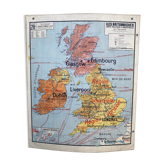
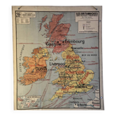
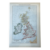
School map British Isles England Hatier n°58 and 58bis By Edouard Bruley years 60-70
This item has found its owner, but other one-of-a-kind items await you. 👇
Discover similar items- Dimensions :
- H122 x W102 x D1
- Color :
- multicolour
- Material :
- paper
- Style :
- vintage
School card cardboard british isles. Double-sided with carnations. Hatier bookstore 60s-70s. By edouard bruley. N°58 physical map and rains / n°58bis economic map and agriculture and livestock. The colors are fresh. However, the map has visible alterations on the front and back (presence of freckles on the edges and spots on the wales area on the front and back, folds marked with cardboard on the lower corners, two holes on one edge, a faded area on the isle of man, traces of use on the carnation areas, a small tear at the bottom, a small gap at the top, a small stain with loss of cover paper in the part "to bergen. See details photos and zoom). Height 122 cm. Width 102 cm.
Earth globes & geographical maps: other similar vintage pieces
Discover more similar items- -11%
- -36%
- -11%
- -21%
- -26%
- -30%
- -11%
- -14%