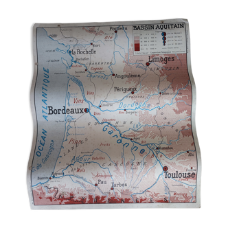
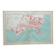
Map of Algiers
- Dimensions :
- H31 x W46 x D1
- Color :
- multicolour
- Material :
- paper
- Style :
- vintage
Original old map dating from 1883. 31x46cm. This is indeed an original old document and not a reproduction. 📦 Shipped flat, folded on itself between several layers of cardboard to make the package unfoldable, this type of old document cannot be rolled. Original central fold is barely visible once unfolded, see photos. Do not hesitate to contact me to make a batch to save on shipping costs: for maps and lithographs you only pay one shipment. This map of Algiers highlights the organization of the city around its bay, a strategic site that shaped its development. The port, both military and commercial, occupies a central place, reflecting the importance of maritime trade and port infrastructure. The old town, with its dense network of alleys, contrasts with the more recent districts and military installations that line the coastline. Public, religious, and administrative buildings are highlighted, testifying to the city's political and economic role. With its blend of red, black, and blue-green tones, this document illustrates the dynamism of Algiers at a time when it was a crossroads between Europe and North Africa.
5 ()