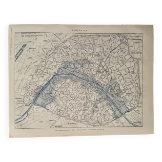
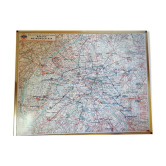
Old map of Paris in the 19th century
🙈 Oops, this product is already sold or unavailable. Discover our 1500 new products or products similar to this item !
- Dimensions :
- H31 x W46 x D1
- Color :
- multicolour
- Material :
- paper
- Style :
- vintage
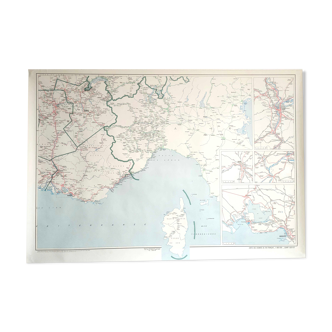
Original old map dating from 1883.31x46cm. This is indeed an original old document and not a reproduction. 📦 sent flat folded on itself between several layers of cardboard in order to make the package unfoldable, this type of old document cannot be rolled. Original central fold is hardly visible once unfolded see photos. Do not hesitate to contact me to make a batch to save on shipping costs: for maps and lithographs you only pay one shipment. **old map of paris - edition a. Fayard** detailed map of **paris**, published by **a. Fayard**, offering a precise representation of the french capital at a time when its urban planning was in full evolution. It highlights the main monuments, boulevards, parks and communication routes, allowing you to appreciate the structure of the city. Made in several shades of **red, green, blue and black**, it clearly distinguishes the buildings, green spaces and the course of the **seine**, a central element of the parisian organization. The suburbs and neighboring communes are also represented, testifying to the expansion of the metropolis. In good condition, this document is a beautiful collector's item, both decorative and informative. It will appeal to fans of **cartography, urban history or parisian heritage** and will easily find its place in an office or library.
5 ()