


Item 1 of 9
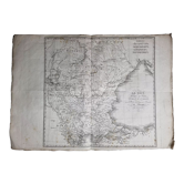
Atlas map of revolutionary France by Carey in Philadelphia 1814
€435
Pay in 3 or 4x with

Atlas map of revolutionary France by Carey in Philadelphia 1814
€435
- Dimensions :
- H32 x W35 x D3
- Color :
- multicolour
- Material :
- paper
- Style :
- vintage
The map is titled: "France Divided into Circles and Departments", the author is Carey Mathew. It dates from 1814 and was produced in Philadelphia. This map is from "Carey's General Atlas", hence the clear mark in the centre; it is the first atlas produced in the United States to systematically incorporate colour into the maps.
🇫🇷 sebastien F.Private sellerSee the shop
New sellerThis seller is starting on Selency, and we already love him. Go for it ❤️
Earth globes & geographical maps: other similar vintage pieces
Discover more similar items- -46%
- -31%





Item 1 of 20