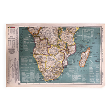
Old map of North Africa — Trade routes & Colonies

- Dimensions :
- H49 x W63 x D1
- Color :
- multicolour
- Material :
- linen
- Style :
- classic
Authentic old map of North and Central Africa, a historical document of exceptional value and rarity. It represents the African continent as it was organised during the colonial era — French Union, Belgian Congo, British West Africa, territories under mandate — with remarkable cartographic precision and a wealth of information. The trade flows depicted are fascinating: peanuts, cocoa, cotton, gold, rubber, oil, livestock — the continent's strategic resources transported to France, Great Britain, the United States, and Belgium. An insert details the Suez Canal, a vital artery of global trade at the time. A unique testimony to a colonial world that has now disappeared, the map offers a striking geopolitical and economic reading of Africa in the mid-20th century. The trilingual legends — French, English, and Spanish — confirm the prestige of this international edition. A rare and valuable piece, equally captivating for historians and appealing to enthusiasts of old cartography and vintage decor. Condition: Very good state of preservation — the colours remain bright and contrasting, and the map exudes a strong and immediate visual presence. Delivery: The map will be carefully protected and packaged with the utmost care to ensure it arrives in perfect condition. Available for free collection in Paris and Lyon.
4.94 ()
Earth globes & geographical maps: other similar vintage pieces
Discover more similar items- -11%